
Other CT Humanities Programs

Creative Commons Licensing

FUNDING CUTS IMPACT CT HUMANITIES: Help CT Humanities navigate recent funding cuts and continue our vital work across Connecticut. All donations made to CTH will be matched dollar-for-dollar up to $50,000. Donate today!
Now Viewing:
Environment
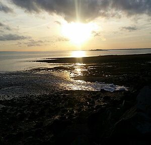
Connecticut’s Environmental History and its Lessons for Today
Connecticut’s history is etched into its landscape: from millennia of…
Read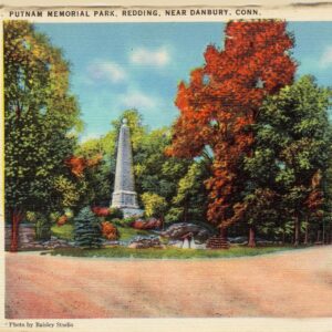
Connecticut’s Valley Forge: The Redding Encampment and Putnam Memorial State Park
As the 1778-79 winter quarters for a division of the Continental army, Putnam Memorial State Park is sometimes referred to as “Connecticut’s Valley Forge.”
Read
Connecticut Discovered Lyme Disease – Who Knew?
The discovery of Lyme disease, and its transmission through ticks, got its start around Lyme, Connecticut in 1975.
Read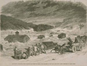
Bursting of the Staffordville Reservoir – Today in History: March 27
On March 27, 1877, the Staffordville Reservoir Company’s dam burst, flooding the valley for a distance of five miles and causing the loss of two lives.
Read
The Socially Dynamic Drumlin of Foss Hill
The changing nature of Foss Hill (on the campus of Wesleyan University) tells the story of evolving cultural influences that altered the landscapes of universities across the country.
Read
Blizzard Halts Mail Delivery – Today in History: February 7
On February 7, 1978, the US Postal Service was unable to deliver mail to many Connecticut residents for the first time in almost 40 years.
Read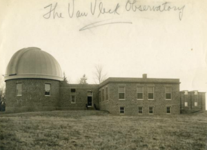
The Van Vleck Observatory: A Reflection of Environmental Conditions
Designers of the Van Vleck Observatory overcame numerous environmental and geographical challenges to help Wesleyan University make an impact on the world’s understanding of the universe.
Read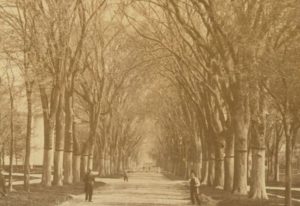
A Beautiful and Goodly Tree: The Rise and Fall of the American Elm
Almost every Connecticut town has an Elm Street, named for the popular trees that grew in abundance until a fungal infestation greatly diminished their numbers.
Read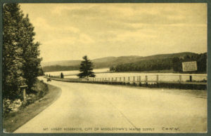
Middletown’s Reservoirs Drive Growth Throughout the 19th and 20th Centuries
The Laurel Brook and Mount Higby Reservoirs helped provide reliable sources of water that drove the growth of Middletown.
Read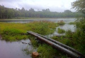
The Story of Connecticut’s Largest State Forest
Pachaug State Forest is the largest state forest in Connecticut and covers approximately 24,000 acres and crossing the borders of numerous towns.
Read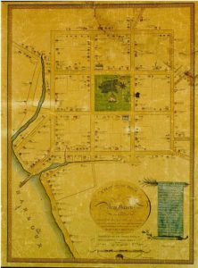
Why Was New Haven Divided into Nine Squares?
The layout of New Haven’s nine-square grid, though not the plan itself, is attributed to the original settlers’ surveyor, John Brockett.
Read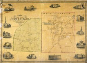
“A Noble and Precious Life”: Edgar M. Woodford, Civil Engineer, Abolitionist, and Soldier
This Avon-born man not only put his talents on the map, literally, he also went west to secure Kansas as a free state.
Read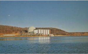
Connecticut Yankee Brings Power to the People
For nearly 30 years the Connecticut Yankee Atomic Power Company operated a nuclear power plant in Haddam Neck, Connecticut.
Read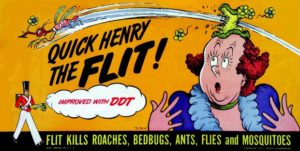
Morton Biskind Warned the World About DDT
A Westport physician named Morton Biskind became one of the first to warn the world about the dangers of DDT. His work ultimately helped inspire the writings of Rachel Carson.
Read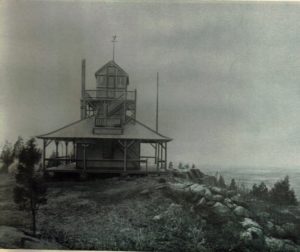
Peter’s Rock: North Haven History with a View
Far from being a mere recreational hotspot, however, Peter’s Rock is a formation with an extensive history of service to the surrounding area.
Read
Discovered Dinosaur Tracks Re-Route Highway and Lead to State Park
Some 200 million years ago, carnivorous dinosaurs roamed Rocky Hill leaving the three-toed tracks that would become our state fossil.
Read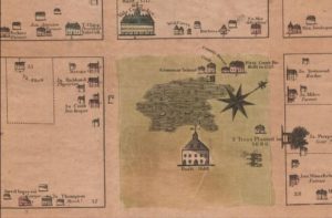
Putting History on the Map
While maps serve a utilitarian function at the time of their production, they become snapshots in time of the memories of those who designed them.
Read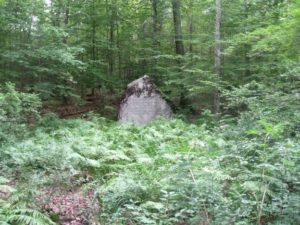
Alain and May White Memorial Boulder
Words of thanks on a stone marker in Litchfield highlight contributions of a brother and sister to land preservation.
Read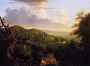
Talcott Mountain: A View of Early New England
The Talcott Mountain range lies in the northeastern section of Avon and is arguably the town’s most prominent geographic feature.
Read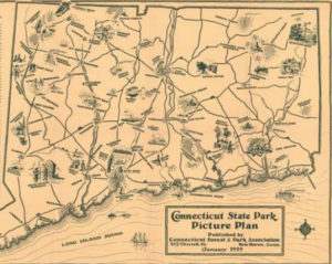
Preserving Connecticut’s Natural Beauty: Connecticut’s First State Parks
Sherwood Island, Mount Tom, Macedonia Brook, and Kent Falls are among the earliest lands set aside as the parks movement took hold in the state.
Read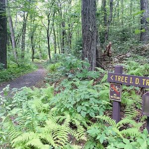
Saving Sessions Woods
After decades as historic family property and summer camp, Sessions Woods became a park after local residents organized to save it from private developers.
Read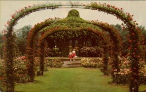
Oldest Rose Garden – Who Knew?
The Elizabeth Park Rose Garden in Hartford is the oldest municipally operated rose garden in the country.
Read
Andover to Woodstock: How Connecticut Ended Up with 169 Towns
Religious mandates, the difficulties of colonial-era travel, and industrialization are a few of the forces that gave rise to the proliferation of towns in our state.
Read
Surveying Connecticut’s Borders
After some 350 years, the matter of where exactly some of the state’s boundaries lie continues to be debated.
Read
Portland Puts Its Stamp on an Architectural Era
The brownstone quarries in Portland, Connecticut, owe their existence to millions of years of prehistoric sediments accumulating in the Connecticut River.
Read
Arbor Day’s Roots in Connecticut – Who Knew?
Connecticut’s Reverend Birdsey Grant Northrop popularized Arbor Day celebrations in schools across the country.
Read
The Park Movement in Hartford
The Hartford City Parks Collection comprises a rich archive, documenting Hartford’s pioneering effort to establish and maintain a viable system of municipal parks and connecting parkways between them.
Read
Mad about Shad: Connecticut’s Love Affair with an Oily Fish
Some Connecticut River towns continue to hold an annual shad festival, replete with a “Shad Queen” and a feast known as a “shad planking.”
Read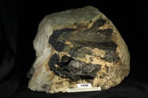
The Industrial Might of Connecticut Pegmatite
Connecticut has a complex and compelling geologic legacy with substantial mineral riches, including pegmatite that has historically been a boon to industry.
Read
A Valley Flooded to Slake the Capital Region’s Thirst
From 1927 to 1948, the Metropolitan District Commission built the Saville Dam and flooded the valley to create the Barkhamsted Reservoir, displacing over a thousand people.
Read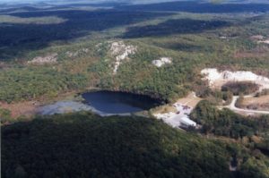
Breaking the Myth of the Unmanaged Landscape
Evidence of early Native land use is etched into the landscape and preserved in oral tradition as well as the historical and archaeological records.
Read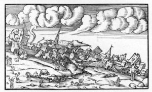
The Surprising Prevalence of Earthquake Activity in Connecticut
Connecticut has experienced thousands of earthquakes since European settled the area, the most active site being the village of Moodus in East Haddam.
Read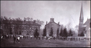
Andrus Field 1831–1911: Athletics and the Environment
The building of Andrus Field on the campus of Wesleyan University demonstrates changes made to the built environment to meet the changing needs of a local community.
Read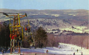
Mohawk Mountain Made Snow for Winter Sports Lovers – Who Knew?
In the 1930s, skiing became a popular pastime at Mohawk State Park in Cornwall and became famous for documenting the first artificial snow.
Read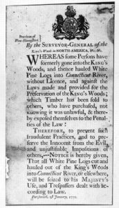
The White Pine Acts – Who Knew?
The British government made it illegal for colonials to cut down white pine trees over 24 inches in diameter—preserving the trees for use as masts on British naval ships.
Read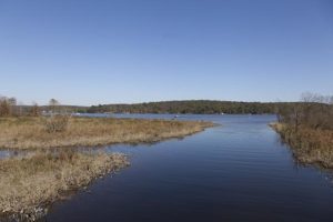
Old Saybrook Faces Down Threats to Its Water Supply
Shallow waterways and shifting sandbars made water navigation hazardous and prevented Old Saybrook from ever becoming a major port city.
Read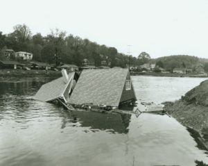
Byram River Flood – Today in History: October 15
A few minutes before 11:00 pm on October 15, 1955, Greenwich officials pulled the alarm signal and declared a state of emergency.
Read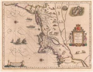
Reckoning with the Dutch: the Treaty of Hartford, 1650
Hartford place names, such as Dutch Point, Huyshope Avenue, and Adriaen’s Landing, are reminders of a time when Connecticut was part of New Netherlands.
Read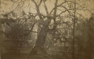
The Charter Oak Fell – Today in History: August 21
On August 21, 1856, the Charter Oak, a noted landmark and symbol of Hartford and Connecticut, fell during a severe wind and rain storm.
Read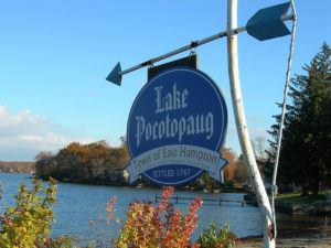
Lake Pocotopaug Shapes the Growth of East Hampton
East Hampton is home to one of Connecticut’s largest inland bodies of water, Lake Pocotopaug.
Read
Reading, Writing, and the Great Outdoors: Frederick Gunn’s School Transforms Victorian-era Education
In 1850, this educator, prominent abolitionist, and outdoorsman founded The Gunnery, a school in Washington, Connecticut.
Read
Creating Candlewood Lake – Today in History: July 15
Candlewood Lake was the first large-scale project in the United States to employ the concept of a pumped-water storage facility.
Read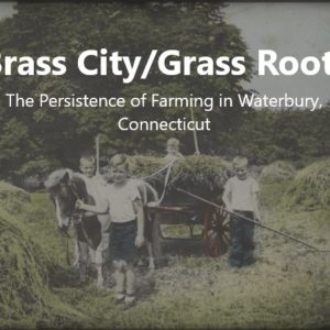
Brass City/Grass Roots: From Farmers to Developers: The Rasmussens of Town Plot
This article is part of the digital exhibit “Brass City/Grass Roots: The Persistence of Farming in Waterbury, Connecticut”
Read Brass City/Grass Roots: The Pierponts of East Farms
This article is part of the digital exhibit “Brass City/Grass Roots: The Persistence of Farming in Waterbury, Connecticut”
Read Brass City/Grass Roots: Remnants and Revivals
This article is part of the digital exhibit “Brass City/Grass Roots: The Persistence of Farming in Waterbury, Connecticut”
Read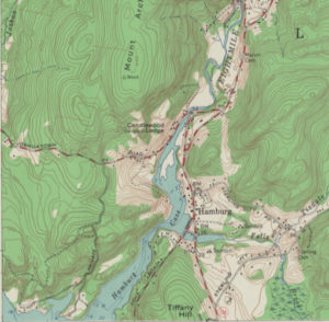
Continuity and Change along the Eightmile River
The history of the Eightmile River illustrates the vital and changing roles that such waterways have played in Connecticut’s development.
Read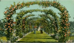
Elizabeth Park’s Rose Garden: June is Busting Out All Over
Boasting 15,000 bushes and about 800 varieties of roses, it is the oldest municipally operated rose garden in the country.
Read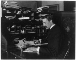
Gifford Pinchot: Bridging Two Eras of National Conservation
Connecticut-born Gifford Pinochet oversaw the rapid expansion of national forest land holdings in the early 1900s.
Read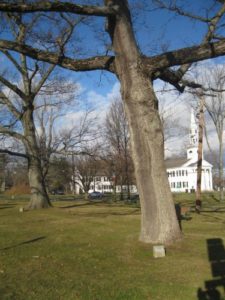
Litchfield’s Revolutionary War Soldiers’ Tree
In 1902, the Daughters of the American Revolution celebrated Arbor Day by planting a tree on the Litchfield Green to commemorate the town’s Revolutionary War soldiers.
Read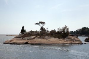
The Thimble Islands – Little Islands with a Big History
While initially uninhabited because of their rocky soil, the Thimble Islands in Branford evolved into both a popular tourist destination and an exclusive residential community.
Read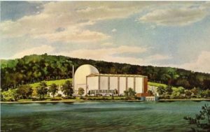
Connecticut Yankee and Millstone: 48 Years of Nuclear Power
In 1968 the prospect of nuclear power energized those hoping to find an alternative to coal, oil, and other fossil fuels.
Read
Rivers of Outrage
Pollution of Connecticut’s waters by industrial waste and sewage in the decades after the Civil War was arguably the state’s first modern environmental crisis.
Read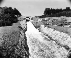
Barkhamsted Reservoir Construction Washes Away a Community
While the Barkhamsted Reservoir project proved successful, it cost 1,000 displaced residents their homes and livelihoods.
Read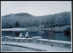
Mr. & Mrs. Rockwell’s Park
In 1914, bell and ball bearing manufacturer Albert Rockwell donated 80 acres of land to the city of Bristol for the creation of a public park.
Read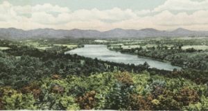
The Connecticut Valley Authority That Never Was
In the early 20th century, supporters of the New Deal tried to recreate the Tennessee Valley Authority in the Connecticut River Valley.
Read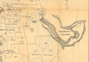
The Battle for Cockenoe Island
In 1967, the United Illuminating Company proposed to build a nuclear power plant on Cockenoe Island off the coast of Westport, but grassroots activism ultimately scuttled that plan.
Read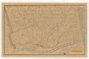
Seth Pease Surveys New Lands
This Suffield native’s work in “New Connecticut” and other Western territories reveals how the new nation took stock of its expanding borders.
Read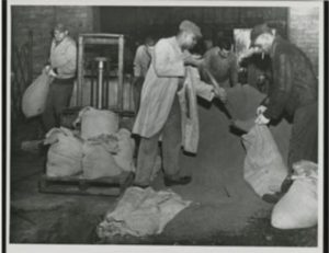
The Flood That We Forget: October 15 and 16, 1955
When we speak of the “Flood of 1955,” we should remind ourselves that two separate floods, one in August and a second one in October, occurred.
Read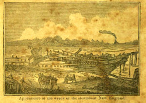
The Steamboat New England: “The shock was dreadful” – Today in History: October 8
One of Connecticut’s worst steamboat disasters occurred on the dark and stormy night of October 8, 1833, on the Connecticut River.
Read
The Great River: Connecticut’s Main Stream
Highway. Barrier. Resource. Sewer. Over the centuries each of these names has been used to describe one of the defining feature’s of the state’s landscape.
Read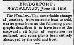
Eighteen-hundred-and-froze-to-death: 1816, The Year Without a Summer
Sunspots and volcanic eruptions led to cooler than normal temperatures in the summer of 1816.
Read
Pope Park – Yesterday and Today
Once the proposed site of Albert Pope’s industrial village, Pope Park has served the recreation needs of the Hartford community for over one hundred years.
Read
An American Heritage River – Today in History: July 27
On July 27, 1998, Vice President Al Gore designated the Connecticut River one of 14 American Heritage Rivers.
Read
Weir Farm the Result of a Trade – Who Knew?
Weir Farm, located in Ridgefield and Wilton, Connecticut, resulted from the trade of a painting and ten dollars.
Read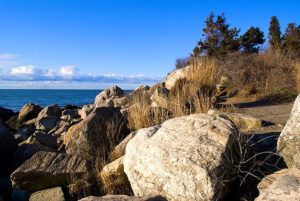
Hammonasset State Park Serves the State and its Residents
Located in Madison, Hammonasset State Park provides visitors with opportunities for swimming, sunbathing, or strolling along the park’s meandering boardwalk.
Read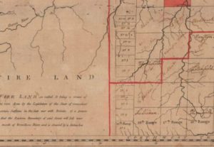
New Connecticut on Lake Erie: Connecticut’s Western Reserve
If you drive through the area of Ohio still called the Western Reserve today, you will find towns named Norwich, Saybrook, New London, Litchfield, Mansfield, and Plymouth.
Read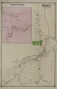
Largest Earthquake in Connecticut – Today in History: May 16
On May 16, 1791, the largest earthquake to shake Connecticut took place in Moodus, an area known for earthquake activity.
Read The Connecticut River
The Connecticut River received a designation as an American Heritage River, and it remains protected as just one of 14 rivers in the country to be recognized as such.
Read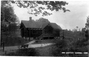
A Woman Ahead of Her Time: Mabel Osgood Wright
This writer and photographer founded the Connecticut Audubon Society and created Fairfield’s Birdcraft Sanctuary.
Read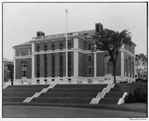
Olin Library and The Debate About Open Space at Wesleyan University
The history of Wesleyan’s library system includes a debate that reveals how values associated with the environment in the early 1900s helped shape the campus’s development.
Read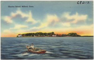
A Good Spot and a Healthy Place: A Short History of Charles Island
Before becoming a part of Silver Sands State Park, Milford’s Charles Island served as everything from a luxury resort to the home of a fertilizer factory.
Read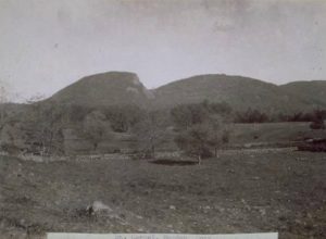
A Volcanic Giant Sleeps in Hamden
The unique ridge that runs east-west just six miles north of New Haven is known as “Sleeping Giant” for its resemblance (from a distance) to a recumbent person.
Read
Hidden Nearby: Two Monuments to Sportsmen at Housatonic Meadows State Park
Two monuments in Housatonic Meadows State Park mark this area’s reputation as one of the finest fly fishing locales in the Northeast.
Read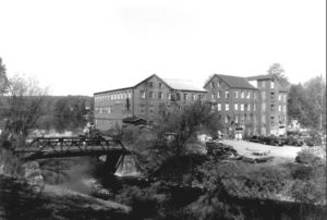
Understanding the Environmental Effects of Industry by Examining the Starr Mill
The development of resources both in and around the Coginchaug River in Middletown were representative of prevailing attitudes about industrial expansion and environmental protection.
Read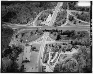
Overland Travel in Connecticut, from Footpaths to Interstates
By overcoming the limitation of distance, transportation makes possible the many economic and social interactions that allow a community, a people, an entire culture, to thrive
Read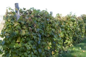
Raise a Glass to Winemaking in Connecticut
The Colony’s first settlers produced wine and spirits, but it would not be until the 1970s that Connecticut could grow and sell its harvest.
Read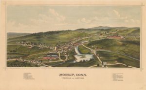
A Bird’s-eye View of Moosup
This depiction of a Quinebaug Valley town and its satellite communities—Uniondale and Almyville—records an idealized view of the 19th-century textile boom.
Read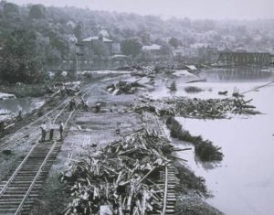
Hurricanes Connie & Diane Deliver Double Hit – Who Knew?
Hurricanes Connie and Diane, which both struck in August 1955, exceeded the combined property damage of the Flood of 1936 and Hurricane of 1938.
Read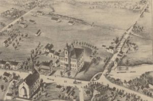
A Bird’s-eye View of Broad Brook
This rendering of the village of Broad Brook depicts a classic New England mill town but takes creative liberties to emphasize the community’s assets.
Read
A Public Responsibility: Conservation and Development in the 20th Century
The seemingly contradictory calls to use or preserve the state’s natural resources are, in fact, closely related efforts that increasingly work in tandem—but not without conflict.
Read
Dynamic Tensions: Conservation and Development up to the 1920s
From indigenous practices to Progressive-era projects, changing attitudes toward natural resources have shaped and reshaped the state’s landscape.
Read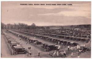
Abundant Wildlife Drives the History of Rocky Neck State Park
Consisting of 710 acres of camping and recreational areas, Rocky Neck State Park is located on Long Island Sound in East Lyme.
Read
A Tale of Shad, the State Fish
The aquatic inhabitant, shad, has a long history of influencing foodways, income, and culture in the region.
Read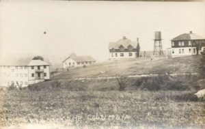
Hidden Nearby: Camp Columbia State Park in Morris
Once an engineering field school for Columbia University, this former campus presents a study in change and adaptation.
Read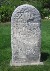
Hidden Nearby: Jedediah Strong’s Milestone
The Litchfield man behind this colonial-era mile marker led an accomplished but, ultimately, tragic life.
Read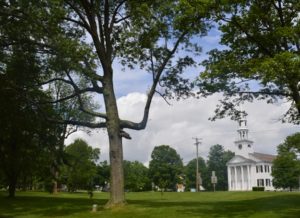
The Constitution Oak
Connecticut, the “Constitution State,” has a unique history of state constitutions. The “constitution” celebrated on our license plates is the Fundamental Orders of 1638.
Read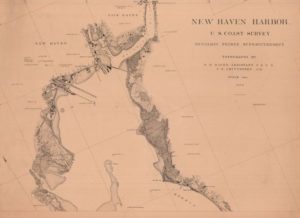
Three Young Engineers: Charting New Haven
When the United States Coast Survey set out to compile detailed charts of New Haven Harbor in the 1870s, they hired recent graduates of Yale’s Sheffield Scientific School as assistants.
Read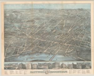
Bird’s-eye Views of Connecticut Offer Idealized Portraits of Progress
Panoramic prints of growing cities and towns became popular in the late 1800s as Connecticut transformed from an agricultural to an industrial state.
Read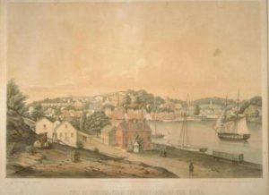
Norwich in Perspective
Two different artistic takes on a prosperous 19th-century mill town and commercial center.
Read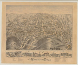
Bird’s-eye Views of Rockville Chart Textile Industry’s Growth
Two depictions, produced 18 years apart, illustrate how the textile boom transformed this borough of Vernon.
Read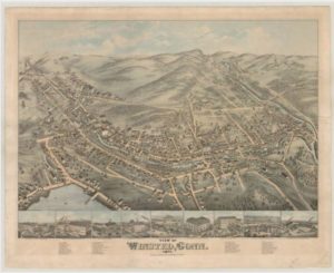
Bird’s-eye Views of Winsted
As bird’s-eye view maps declined in popularity during the early 20th century, artists incorporated technical advances in hopes of reversing the trend.
Read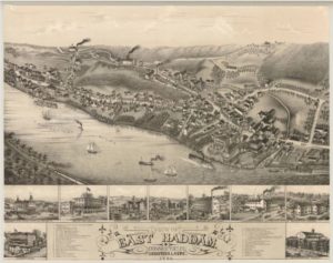
A Bird’s-eye View of East Haddam
In 1880, East Haddam was already a popular tourist destination and, despite its small size, boasted two steamboat landings to accommodate visitors.
Read
Artist Roger Tory Peterson, a Champion for the Natural World
Artist, author, and influential conservationist Roger Tory Peterson pioneered the modern age of bird watching with his 1934 book, A Field Guide to the Birds.
Read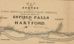
Windsor Engineers Success
In recognition of the importance of the canal and the village in fostering local economic development, the area was given the name Windsor Locks in 1854.
ReadMore Articles