


By Nancy Finlay
All maps are historical. They represent specific moments in time and very quickly become out of date as new towns are incorporated, new canals or railroads or highways are built. Some maps, however, are not only historical, but deliberately retrospective. They represent a time other than the time in which they were made, sometimes a time within the living memory of the mapmaker, sometimes an historic era long past.
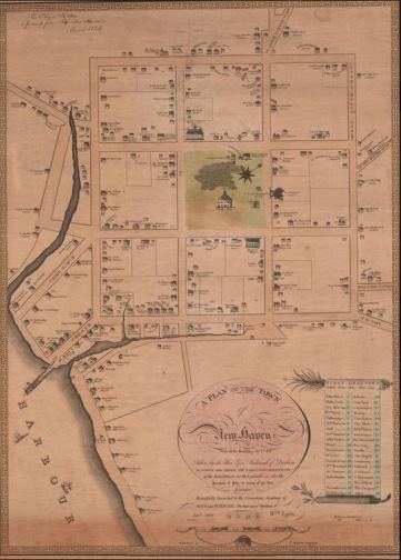
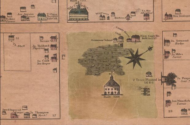
Plan of the Town of New Haven With all the Buildings in 1748. Drawn by James Wadsworth. Engraved by Thomas Kensett, 1806 – Connecticut Historical Society
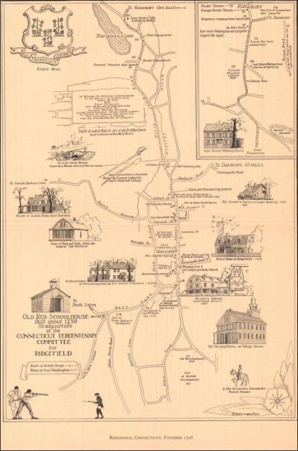
Ridgefield, Connecticut, Founded 1708. Drawn by Robert Cooper Barr, 1935 – Connecticut Historical Society
Some of the earliest such maps at the Connecticut Historical Society incorporate the memories of very old men. James Wadsworth drew his map of New Haven in 1748, when he was an 18-year-old student at Yale. When it was finally printed and published in 1806, almost 60 years later, it had become an historic document, recording the appearance of New Haven not only before the American Revolution, but even before the French and Indian War. The popular author Douglas Grant Mitchell (known as “Ike Marvel”) was born in Norwich in 1822. As an old man he produced a map of Norwich in 1830, as it would have appeared when he was eight years old. In addition to the names of residents, businesses, and geographical features, the map also shows where Mitchell found “early peas” and “cranberries” and where he went skating.
Other historical maps reflect the historic consciousness of communities, the collective memory of their citizens. Such maps were often issued in conjunction with anniversaries celebrating a town’s founding, or especially significant events in the town’s history. A map of Ridgefield, issued in 1935, in conjunction with the celebration of Connecticut’s Tercentenary, shows the sites of important events associated with the Battle of Ridgefield during the Revolutionary War, including the sites of the first and second engagements, the place where Benedict Arnold lost his horse, and the spot where General Wooster was shot. About the same time, Katherine G. Bartholomew and Dorothy G. Spalding drew their Cultural and Historical Map of Hartford, showing the sites of the Charter Oak, the Old Jail, and the homes of Hartford’s famous 19th-century authors. The map won first prize in the Junior League’s educational map contest in 1933.
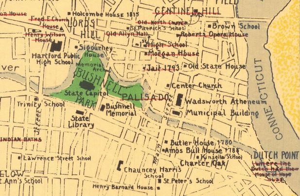
Detail of Downtown Hartford from A Cultural and Historical Map of Hartford. Drawn by Katherine G. Bartholomew and Dorothy G. Spalding. Printed by The Kellogg & Bulkeley Co., 1933 – Connecticut Historical Society
Nancy Finlay, formerly Curator of Graphics at the Connecticut Historical Society, is the editor of Picturing Victorian America: Prints by the Kellogg Brothers of Hartford, Connecticut, 1830-1880.
© Connecticut Public Broadcasting Network and Connecticut Historical Society. All rights reserved. This article originally appeared on Your Public Media
With funding from Connecticut Humanities, The Connecticut Historical Society recently concluded an ambitious project to digitize and catalog its map collection.
Note: ConnecticutHistory.org does not edit content originally published on another platform and therefore does not update any instances of outdated content or language.


