


Ashford’s location between Boston and Hartford once made it an important center for travel and commerce. Its thoroughfares date back to some of the earliest settlements in the New World. The first significant passage through what would become Ashford was the Old Connecticut Path, a Native American thoroughfare that led west from the Massachusetts Bay area to the Connecticut River Valley. By the 1600s, Nipmuc farmers in the valley loaded supplies from their harvests and headed for the mouth of the Charles River to trade corn and other crops in exchange for metal and cloth goods supplied by English colonists.
In 1636, Thomas Hooker led approximately 100 of his followers down this path on their way to founding Hartford, Connecticut. Traders, merchants, and consumers passed through the Ashford area on their journeys to establish colonies and, in doing so, fostered the economic development that transformed the North American continent. Ashford itself was incorporated as a town in October of 1714.
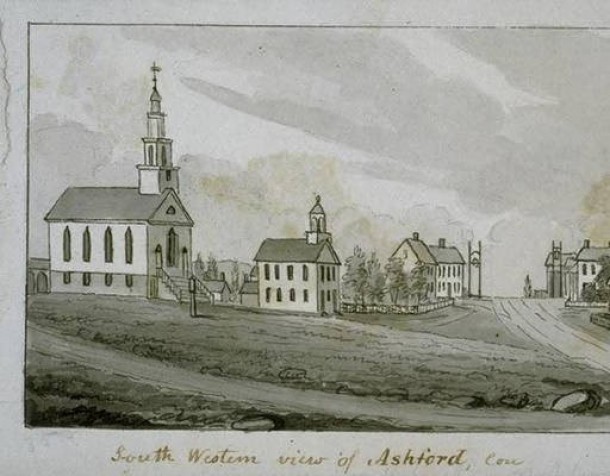
Location Fosters Growth
As years passed, the residents of Ashford recognized the commercial value of the well-traveled route through their town and began building and maintaining bridges over waterways to facilitate travel through Ashford. In 1797, traffic increased with the Boston Turnpike Company’s construction of the Boston and Hartford Turnpike. The turnpike began in East Hartford and made its way through Ashford and West Ashford before winding its way to Boston. The turnpike loosely followed the path of today’s US Route 44, which makes it way from eastern New York, through northern Connecticut and Rhode Island, and on to southern Massachusetts.

Map detail Turnpikes of Connecticut, The Turnpikes of New England by Frederic J. Wood
By the early 1800s, travel through Ashford facilitated the creation of numerous small stores, grain mills, saw mills, and tanneries. Then, in 1809, the Tolland County Turnpike Company received its charter and began work on the Tolland County Turnpike, which opened about a year later. Its route carried travelers through Ellington, Tolland, and Willington to the Boston Turnpike in Ashford. Together, these turnpikes produced a steady stream of farmers and traders moving through the area.
Advent of Railroad Puts Town on a New Course
Despite the initial success of the turnpike system flowing through Ashford, the town’s topography limited its long-term prospects. River valley towns like Stafford and Willimantic proved better sites for constructing railroad passages. As a result, towns with railroads became the hubs of local mills and industry. Ashford residents began leaving the area in search of jobs, and the town’s population of 2,651 in 1840 decreased by more than half in the following 10 years. It continued decreasing well into the following century, when in 1940, the census reported only 704 people living in Ashford. Today, having rebounded demographically, Ashford is no longer considered a transportation hub but is instead known as a residential community and the home of the June Norcross Webster Scout Reservation and the late-Paul Newman’s The Hole in the Wall Gang Camp.


