By Kate Steinway
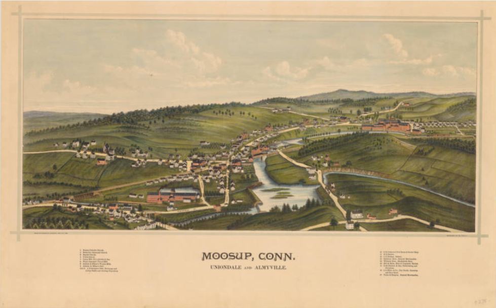
In the late 1800s, panoramic illustrations, known as bird’s-eye views, became a popular means of portraying towns throughout Connecticut as the industrial age transformed them from agrarian hamlets into booming economic centers. Bird’s-eye view lithographs, such as the one seen here, earned their name because the city or town depicted was rendered as though seen from a high vantage point. Although these prints often idealized the built environment’s virtues and downplayed its flaws, they nonetheless provide historians with useful information.
This 1889 view of Moosup (today a village of Plainfield) is by Lucien Burleigh. Educated to be a civil engineer, Burleigh switched to a career as artist, lithographer, and view publisher and is one of the few artists of a large number of views to have operated his own lithographic printing establishment. Burleigh’s bird’s-eyes are drawn from a lower perspective than those by O.H. Bailey, a prolific Boston-based publisher. Creating eerily unpopulated cities, Burleigh left out the tiny figures and animals that populate Bailey’s views. His carefully rendered buildings and streets are united by the deep, rich greens of his views.

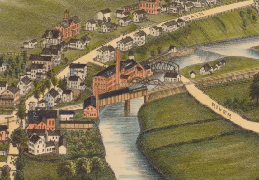
Detail of the Cranska Thread Mill (#6, center) from Moosup, Conn. Uniondale and Almyville, Troy, NY: L.R. Burleigh,1889, tinted lithograph with hand-coloring by Lucien Rinaldo Burleigh artist, lithographer & publisher – Connecticut Historical Society and Connecticut History Online
Burleigh’s depiction of this Quinebaug Valley town and its satellite communities, Uniondale (left) and Almyville (right), records the appearance of a typical mill town common in northeastern Connecticut during the late 19th-century textile boom. Drawn to Moosup by its easily accessible source of water power, the Cranska Thread Mill (#6, center), the Uniondale cotton industry (#5, lower left), and Almyville’s Aldrich and Milner Woolen Mills (#7, right center) are each housed in large brick buildings, surrounded by workers’ tenement houses. In addition to providing employment for many local residents and French Canadian immigrants, Aldrich and Milner were responsible for endowing the town’s library and a recreation hall (#8, right center).
Kate Steinway, Executive Director of the Connecticut Historical Society (CHS) in Hartford, curated the traveling exhibition, Hamlets & Hubs; Bird’s-Eye Views of Connecticut Towns, 1849-1908 (1987-88), from which this article is derived, while Curator of Prints and Photographs at CHS.


