


The town of Sharon, like many early communities in the colony, required basic road and bridge infrastructure in order to maintain a thriving community. Early roads, no more than rough trails and paths, often followed older Native American routes. As surveyors mapped new towns, they made allowance for roads between proprietary allotments, often in a rectilinear grid pattern (inevitably disrupted by geographic realities). In 1739 the newly formed town highway committee proposed that, in addition to Sharon’s principal north-south road, they lay side roads ½ mile apart that ran in an east-west direction. Additional north-south highways, also ½ mile apart, would complete the grid system. A small number of through routes included roads from Litchfield to Poughkeepsie and Hartford to Albany; the latter passed across the upper end of Sharon Green, while the road to Poughkeepsie crossed Sharon Mountain.
A Turnpike Comes to Sharon
In the 1790s, the Goshen and Sharon Turnpike (chartered in 1803) and the Sharon and Cornwall Turnpike (begun in 1809) came to Sharon. These privately owned toll roads had a marked impact on the town. In 1807, Kellogg Berry built a home on the corner of Main Street and Route 4 (Goshen-Cornwall Turnpike). In 1817, he sold the house and property to Major David Gould who recognized the site’s business prospects and over the years established a store, lumberyard, and other shops. By the late 1830s and into the 1840s, railroad construction through the region accelerated the push to turn private turnpikes into public roads.
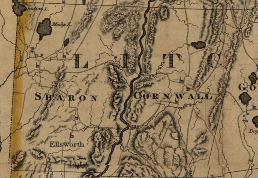
Detail of Sharon from Map of Connecticut, from actual survey by Moses Warren, Hudson & Goodwin. Hartford, CT, 1811 – University of Connecticut Libraries, Map and Geographic Information Center (MAGIC)
Sharon’s Roads in the 20th Century
The modern regional road network, which includes Routes 4, 41, 44, and 63, was not finalized until 1909. In 1924, the General Assembly allocated receipts from gasoline taxes to road construction, including road-paving projects. The money helped pave both Sharon village streets and several through routes in the 1920s, and many of the small concrete bridges still in use today were constructed as part of this initial road-paving campaign. By 1917, automobiles traveled local roads. School buses appeared in town circa 1920, replacing the horse-drawn wagons that had previously transported schoolchildren.
The road network in Sharon remains much the same as it has been since the 1920s, a system composed of two-lane rural roads and small bridges that exert relatively minimal impact on the environment. Periodic improvements have been largely confined to upgrading safety features, straightening dangerous curves, installing occasional passing lanes, and replacing deteriorated bridges. In addition, Sharon maintains many miles of unpaved roads.
A version of this article originally appeared on the Sharon Historical Society website.


