


by Barbara Austen
If you drive through the area of Ohio still called the Western Reserve today, you will find towns named Norwich, Saybrook, New London, Litchfield, Mansfield, and Plymouth. Many of these communities have a town green or square and the ubiquitous white-steepled church common to Connecticut.
When Europeans began settling the Atlantic seaboard of what became the United States, no one knew how far the land extended. As a result, many colonies, including Connecticut, were given vague charters of conveyance that implied they had rights to land far to their west. This led to numerous boundary disputes between the states. The new federal government stepped in to settle these disputes, and on September 13, 1786, Connecticut relinquished its claims except for a 120-mile long strip along Lake Erie, called the Western Reserve.
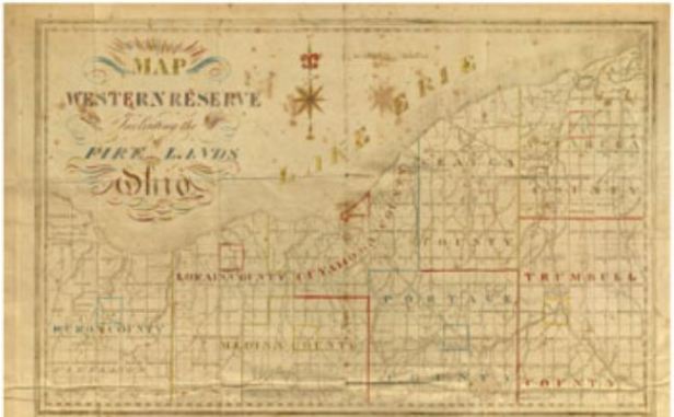
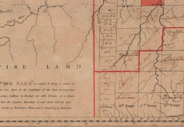
Map of the Western Reserve Including the Fire Lands. Hand colored engraving published by William Sumner, 1826. 1990.181.1 — Connecticut Historical Society
Ohio Place Names Reveal Connecticut Connections
The western portion of the Reserve was used to compensate individuals who had lost their homes when the British burned Fairfield, Danbury, and New London in the Revolution and was known as the Firelands. The State sold the eastern portion of the Reserve to the Connecticut Land Company. The Company then hired Moses Cleaveland to survey the land and lay out townships, and settlers began traveling to the Reserve via Lake Erie.
The Hart and Jarvis families of Hartford and Saybrook were among those who purchased land in the Western Reserve. The town of Hartsgrove, Ohio, located about 50 miles east of Cleveland, is named for Connecticut’s Hart family. The family also purchased land in Sheffield, Ohio, west of Cleveland. The Hart and Jarvis family papers at the Connecticut Historical Society include letters between William Hart and his agent, Simon Perkin, and maps of their western land purchases. Like many others, Hart bought western land as an investment and hired agents to sell the land to people wishing to migrate.
In 1800, when the Western Reserve became part of the Northwest Territory, it was named Trumbull County after Connecticut Governor Jonathan Trumbull. In 1803, Trumbull County became part of the new state of Ohio.
Barbara Austen is the Florence S. Marcy Crofut Archivist at the Connecticut Historical Society.
© Connecticut Public Broadcasting Network and Connecticut Historical Society. All rights reserved. This article originally appeared on Your Public Media
Note: ConnecticutHistory.org does not edit content originally published on another platform and therefore does not update any instances of outdated content or language.


