By Kate Steinway
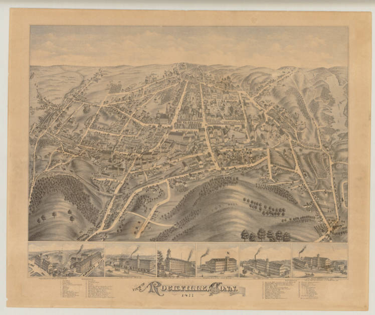
In the late 1800s, panoramic illustrations, known as bird’s-eye views, became a popular means of portraying towns throughout Connecticut as the industrial age transformed them from agrarian hamlets into booming economic centers. Bird’s-eye view lithographs, such as these 1877 and 1895 depictions of Rockville, earned their name because the city or town depicted was rendered as though seen from a high vantage point. The artist of the earlier view, known only by his initials “G.S.,” appealed to citizens’ civic pride by exaggerating signs of the town’s prosperity, a not uncommon device of viewmakers. For example, the mills along the Hockanum River (center), the churches and opera house, and the two public schools (all at upper center and right) are much larger in scale than the homes surrounding them.
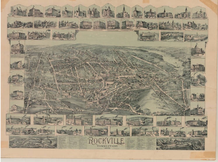
Rockville, Connecticut, Boston: O.H. Bailey & Co., 1895 – Connecticut Historical Society and Connecticut History Online
Although these prints often idealized the built environment’s virtues and downplayed its flaws, they nonetheless provide historians with useful information. These two views of Rockville capture a critical period of growth for this textile mill center. In fact, in 1889, flush with the dividends of a bustling economy, Rockville incorporated as a city.
Signs of Expansion and Civic Pride
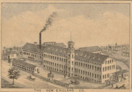
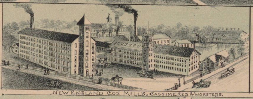
A comparison of the vignettes of Rockville’s mills in the two views shows that within the space of some 18 years, textile operations had grown from single buildings to large complexes. The New England Company, for example, grows from one large building with a few smaller ones clustered about it (1877: #23, lower right and vignette) to three large, multistory buildings (1895: #18 and vignette). Rockville’s woolen mills produced fabrics ranging in quality from “shoddy” to “fancy.” Such was the reputation of their higher-end goods that three US Presidents chose materials made by these mills for their inauguration suits.
Detail of The New England Co. from View of Rockville, Conn., Boston: O.H. Bailey & Co., 1877 – Connecticut Historical Society and Connecticut History Online
Also visible are utilities, such as the Rockville and Ellington Railroad Company and the gas and electric light works (1877: Union Street, left; 1895: #25, left and vignette). These conveniences existed in most urban areas by the 1870s. Recreational amenities, too, were highlighted in bird’s-eye views. Paralleling the development of parks in cities, recreation areas, such as Snipsic Lake in Rockville, became popular during the latter half of the 19th century. Steamboats, small sailboats, and canoes are visible on the lake in both views.
After this period of expansion, the textile industry in New England entered a long period of decline. Today some of the mills survive as apartment buildings (1877: #22 The Florence Mills, left center) and as sites of redevelopment efforts (1877: #20 The Hockanum Mills, far left center). Centrally located, these mills were targets for urban renewal when the textile industry fled South in the mid-20th century. The Rock Manufacturing Company (1877: #25, center;l895: #20, center) site is now a downtown shopping plaza and home to the city courthouse. Rockville itself is now a census-designated place and, since 1965, a borough of the town of Vernon.
Detail of New England Co.’s Mills from Rockville, Connecticut, Boston: O.H. Bailey & Co., 1895 – Connecticut Historical Society and Connecticut History Online
Kate Steinway, former Executive Director of the Connecticut Historical Society (CHS) in Hartford, curated the traveling exhibition, Hamlets & Hubs; Bird’s-Eye Views of Connecticut Towns, 1849-1908 (1987-88), from which this article is derived, while Curator of Prints and Photographs at CHS.