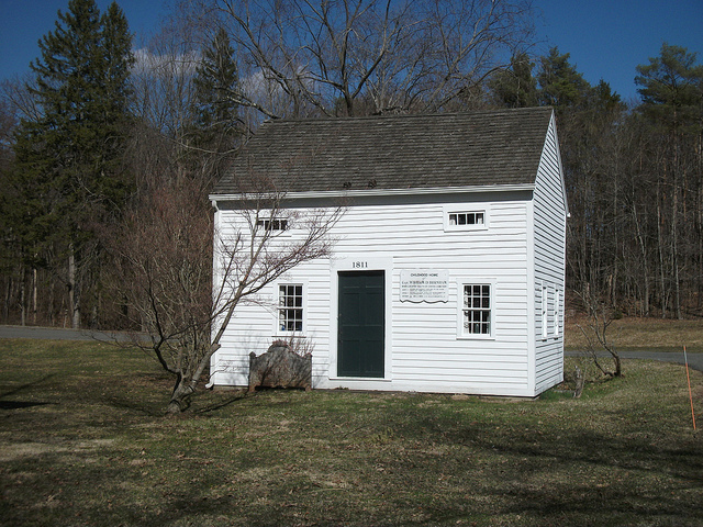
Childhood home of Captain William D. Burnham, Bridgewater

Childhood home of Captain William D. Burnham, Bridgewater – Doug Kerr

The Housatonic and Shepaug rivers meet at the southern tip of this town in lower Litchfield County. Originally the Shepaug Neck section of New Milford, Bridgewater incorporated in 1856. Long an agricultural community characterized by tobacco, dairy farming, and animal husbandry, Bridgewater experienced limited industrial development. In the 1800s, a mail-order toiletries business run by entrepreneur Charles B. Thompson and a hat-making factory were chief among the town’s enterprises. Today, the Sunny Valley Preserve, a 1,850-acre network of wetlands, meadows, woods, and farmland, honors the town’s agricultural heritage by educating visitors about environmentally compatible farming.

Learn More

Documents

“Bridgewater Collection.” Connecticut Digital Archive, n.d. Link.
“Map - South Part of Litchfield Co., Connecticut from Page 214 & 215 of Town and City Atlas of the State of Connecticut.” Real Property. Boston, MA: D.H. Hurd & Co., 1893. University of Connecticut Libraries, Map and Geographic Information Center - MAGIC. Link.
Fagan, L. “Map of New Milford, Litchfield Co., Conn. Surveyed by L. Fagan, Sketches by Edgar Beman.” New Milford; Bridgewater, CT: Richard Clark, 1853. Connecticut Historical Society. Link.

Books

Bridgewater Historical Society. Bridgewater Historical Landmarks. Bridgewater, CT: Historical Society of Bridgewater, 1956.
J.W. Lewis & Company. History of Litchfield County, Connecticut, with Illustrations and Biographical Sketches of the Prominent Men and Pioneers. Philadelphia, PA: J.W. Lewis & Company, 1881. Link.
Orcutt, Samuel. History of the Towns of New Milford and Bridgewater, Connecticut, 1703-1882. Hartford: Case,  Lockwood and Brainard Company, 1882. Link.
Green, Jeannine. Roxbury and Bridgewater. Charleston,  SC: Arcadia, 2011.