at Bradley International Airport, Windsor Locks, Connecticut</em> - <a href=\"https://www.loc.gov/item/2012630923/\">Library of Congress, Prints and Photographs Division, The George F. Landegger Collection of Connecticut Photographs in the Carol M. Highsmith's America</a>")
Carol Highsmith, New England Air Museum (NEAM) at Bradley International Airport, Windsor Locks, Connecticut – Library of Congress, Prints and Photographs Division, The George F. Landegger Collection of Connecticut Photographs in the Carol M. Highsmith’s America
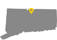
The Hartford County town of Windsor Locks sits on the Connecticut River’s west bank, roughly halfway between Hartford and Springfield, Massachusetts. Originally part of Windsor, Windsor Locks incorporated in 1854. At the southern end of the Enfield Falls Canal, which opened in 1829, the town took part of its name from the locks. These controlled water levels in the canal and allowed vessels to safely bypass a dangerously shallow stretch of the river. Industry also sprung up in town and with it a vibrant working-class community. Windsor Locks’ native Ella Grasso, who became Connecticut’s first woman governor in 1975, hailed from such roots. Today, as home to Bradley International Airport, Windsor Locks remains a vital transportation hub.
More on Windsor Locks from the CT Digital Archive
Browse more interactive content on the CT Digital Archive website.Read More
Featured

Bradley International Airport Transforms Windsor Locks into Regional Gateway
Bradley International Airport in Windsor Locks is Connecticut’s largest airport and the second largest in New England. …[more]
Learn More
Places
“New England Air Museum,” 2016. Link.
“Noden-Reed Park Museum,” 2017. Link.
Department of Energy & Environmental Protection. “Windsor Locks Canal State Park Trail,” 2017. Link.
Documents
Hughes & Bailey. “Aero View of Windsor Locks, Connecticut, 1913.” Bird’s-eye. New York: Hughes & Bailey, 1913. University of Connecticut Libraries, Map and Geographic Information Center - MAGIC. Link.
“Map - Windsor Locks.” 1859. Connecticut History Online, University of Connecticut Libraries, Archives & Special Collections. Link.
Yale Universiry Library, Beinecke Library. “Maps - Windsor Locks, Hartford County, Connecticut (1885- 1912) - Sanborn Fire Insurance Maps,” 2017. Link.
Smithsonian Institution, National Air and Space Museum. “Photograph - Pressure Suit, MOL, with Thermal Coverlayer by Hamilton Standard, ca. 1960s,” 2017. Link.
O.H. Bailey & Company. “View of Windsor Locks, Conn. 1877.” Bird’s-eye. Boston, MA: Bailey & Company, 1887. University of Connecticut Libraries, Map and Geographic Information Center - MAGIC. Link.
Connecticut State Library Digital Collections. “Windsor Locks - WPA Architectural Survey,” 2017. Link.
“Windsor Locks Collection.” Connecticut Digital Archive, n.d. Link.
Books
Palshaw, Thomas C. Bradley Field: The First 25 Years. Windsor Locks, CT: The New England Air Museum, 2011.
Stiles, Henry. The History and Genealogies of Ancient Windsor, Connecticut Including East Windsor, South Windsor, Bloomfield, Windsor Locks, and Ellington. 1635-1891. Genealogies and Biographies. Vol. 2. Hartford, CT: Case, Lockwood & Brainard Company, 1891. Link.
Stiles, Henry. The History and Genealogies of Ancient Windsor, Connecticut Including East Windsor, South Windsor, Bloomfield, Windsor Locks, and Ellington. 1635-1891. History. Vol. 1. Hartford, CT: Case, Lockwood & Brainard Company, 1891. Link.
Windsor Locks Historical Society. The Story of Windsor Locks, 1663-1976. Windsor Locks, CT: Windsor Locks Historical Society, 1976.
Stansfield, Leslie. Windsor Locks. Charleston, SC: Arcadia, 2003.
Giannuzzi, Maria. Windsor Locks Canal. Charleston, SC: Arcadia, 2007.
Find Windsor Locks