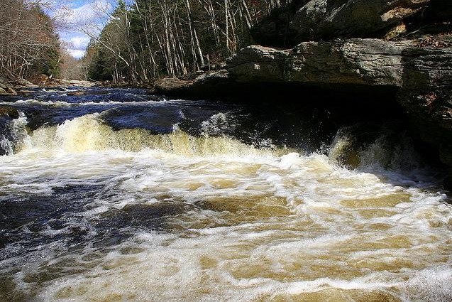
Diana's Pool, Natchaug River, Chaplin

Diana’s Pool, Natchaug River, Chaplin – Carlo Ruggiero

Chaplin, in Windham County, is located in the northeast, or Quiet Corner, of Connecticut. Originally part of Joshua’s Tract (land deeded by Mohegan Chief Uncas’s son to English colonists), the town was named in 1809 for Deacon Benjamin Chaplin, an early landowner and surveyor. The town was incorporated in May of 1822 from parts of Hampton, Mansfield, and Windham. Silk manufacturing and other small industries grew along the Natchaug River, which bisects the town diagonally from the northwest to the southeast. Today Chaplin lies in the region known as the Quinebaug and Shetucket Rivers Valley National Heritage Corridor, or the The Last Green Valley.

More on Chaplin from the CT Digital Archive

Browse more interactive content on the CT Digital Archive website.

Read More

Learn More

Websites

“The Last Green Valley,” 2017. Link.

Documents

Connecticut State Library Digital Collections. “Chaplin - WPA Architectural Survey,” 2016. Link.
“Chaplin Collection.” Connecticut Digital Archive, n.d. Link.
Woodford, E. M. “Map of Windham County, Connecticut.” Philadelphia, PA: E.M. Woodford, 1856. University of Connecticut Libraries, Map and Geographic Information Center - MAGIC, Yale University Library, Map Collection. Link.
Lee, Stephen. “Windham County, Conn., Business Directory Containing the Names, Business and Location of All the Business Men in the County, Agricultural, Manufacturing, and Other Statistics, with a History of Each Town.” Windham County Transcript Office, 1861. Link.

Books

Bayles, Richard, ed. History of Windham County, Connecticut. New York, NY: W. W. Preston & Company, 1889. Link.
Larned, Ellen. History of Windham County, Connecticut. 1760-1880. Vol. 2. Worcester,  MA: Ellen Larned, 1874. Link.